250+ ACRES
Potential Watershed Restoration
≈5:1
Potential Restoration Acres Per Residence
≈2 MILES
Potential TREC Trail Extension
≈50 HOMES
Limited Waterfront Development
A different model for stewardship. Lake Sara 2030 explores whether limited, carefully planned development can help finance the acquisition, restoration and long-term stewardship of a substantially larger landscape — creating an opportunity to improve watershed health, restore habitat and expand public recreation while preserving the majority of the land in a natural setting.
THE WATERSHED COMES FIRST
Protecting Lake Sara starts before the water reaches the lake.
Lake Sara is the collection point for thousands of acres of surrounding watershed. Rainfall moving across agricultural land, tributaries and drainage corridors can carry soil, sediment and nutrients downstream. Lake Sara 2030 proposes looking beyond the immediate shoreline.
The concept is to assemble a substantial area of strategically located agricultural land and evaluate opportunities to convert selected acreage into native prairie, riparian forest, wetlands, protected stream corridors and other conservation practices designed to slow, filter and retain runoff before it reaches Lake Sara.

Conceptual watershed framework only. Final boundaries, restoration practices, lake configuration, residential areas and public-access corridors would be established through land assembly, surveying, environmental analysis, engineering and agency review.

THE RESTORATION FRAMEWORK
THE TARGET
A LOCAL PRECEDENT
Watershed protection is already part of Lake Sara’s history.
The Effingham Water Authority has previously worked with the Illinois EPA on federally supported Section 319 shoreline restoration and stabilization projects at Lake Sara. These historic projects are precedent for conservation activity at Lake Sara, including techniques intended to address shoreline erosion and sediment and nutrient loading. They are not part of Lake Sara 2030, do not establish expected outcomes for this concept, and do not imply Effingham Water Authority or Illinois EPA support or participation.
LAKE SARA SHORELINE PROTECTION
of shoreline addressed in an earlier project
LAKE SARA SHORELINE STABILIZATION
of shoreline addressed in a subsequent project
Historical Effingham Water Authority / Illinois EPA projects shown for context only. Lake Sara 2030 is a separate preliminary concept and no agency participation or environmental outcome should be inferred.
MEASURE THE DIFFERENCE
If it cannot be measured, it should not be claimed.
ACRES — Row crop retired from production — TO BE MODELED
ACRES — Native habitat restored — TO BE MODELED
ACRES — Wetlands created or restored — TO BE MODELED
LINEAR FEET — Tributary restored — TO BE MODELED
TONS / YEAR — Estimated sediment reduction — TO BE MODELED
LBS / YEAR — Estimated phosphorus reduction — TO BE MODELED
LBS / YEAR — Estimated nitrogen reduction — TO BE MODELED
ACRES — New forest / riparian buffer — TO BE MODELED
Future environmental claims should be supported by third-party watershed modeling, conservation planning and appropriate agency review.
REGIONAL PLANNING CONTEXT
Themes Consistent With Effingham’s Long-Term Planning
Lake Sara 2030 touches themes identified in the Effingham 2050 Comprehensive Plan, including coordinated growth near Lake Sara, trail connectivity, environmental stewardship, infrastructure planning and regional collaboration. These parallels provide planning context only and do not represent City review, approval or endorsement of this concept.
EFFINGHAM 2050
“Lake Sara continues to be an important part of the community’s broader growth strategy.”
HOW THE CONCEPT RELATES
The concept explores a deliberately low-density residential expansion intended to broaden housing choice while preserving the landscape that defines the west end of the lake.
EFFINGHAM 2050
“The trail can continue to expand access further into the Lake Sara community.”
HOW THE CONCEPT RELATES
The broader Lake Sara 2030 project area could preserve a potential trail corridor while helping explore a western connection between the north and south sides of Lake Sara. Any connection beyond the project boundary would depend on adjoining landowners, appropriate public entities, technical study and future approvals.
EFFINGHAM 2050
Lake Sara’s continued development requires “thoughtful coordination between jurisdictions, environmental stewardship, and infrastructure planning.”
HOW THE CONCEPT RELATES
The concept prioritizes natural drainage, wetland preservation, shoreline quality, wastewater planning, utility feasibility, and agency review before development proceeds.
EFFINGHAM 2050
“Create connections to Lake Sara via Fayette Avenue to the south and County Road 1550 to the north.”
HOW THE CONCEPT RELATES
The concept may offer an opportunity to coordinate private development with broader regional transportation, trail, recreation and infrastructure themes. The planning document identifies improved connections to Lake Sara as a long-term objective; it does not endorse a particular project or route.
THE ECONOMIC MODEL
Limited development. Broader restoration.
≈50
WATERFRONT RESIDENCES
ACRES OF POTENTIAL RESTORATION + LONG-TERM LAND STEWARDSHIP
LANDSCAPE AND WATER STEWARDSHIP
Planning Around the Lake, Not Against It
NATURAL DRAINAGE
Preserve creek corridors and existing drainage patterns wherever practical.
WETLAND AND WOODLAND PROTECTION
Use development setbacks, selective elevated crossings, and continuous preserved corridors to reduce unnecessary disturbance.
RESPONSIBLE WASTEWATER PLANNING
Evaluate centralized wastewater infrastructure, professional long-term operations, treatment capacity, and future expandability before finalizing development density.
LAKE OPERATIONS
Design the concept around Lake Sara’s existing operating requirements and applicable EWA, environmental, and regulatory approvals.
WATER QUALITY + PUBLIC INFRASTRUCTURE
The concept would evaluate centralized wastewater service rather than individual septic systems for the new community. Where technically and financially practical, the system could also be designed with capacity and connection points that preserve the option for broader Lake Sara service in the future. Any future expansion beyond the project would require separate planning, voluntary participation, engineering, financing and approvals.
CENTRALIZED FROM THE START
No individual septic systems would be planned within the new community if centralized service is determined to be technically and financially feasible.
DESIGNED TO EXPAND
Evaluate treatment capacity, collection routes, easements and future connection points that could preserve optional service opportunities beyond the project over time.
PROTECTING A PUBLIC WATER SUPPLY
Plan accountable wastewater management for the new community while preserving technically feasible future options around an important public water-supply lake.
A PUBLIC BENEFIT
Restore the landscape. Reconnect people to it.
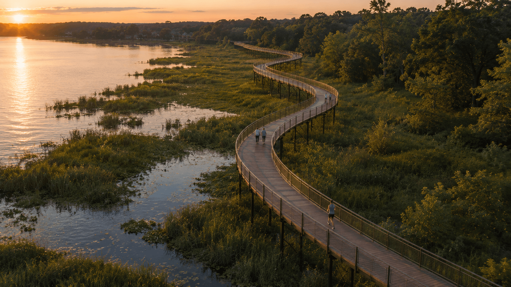
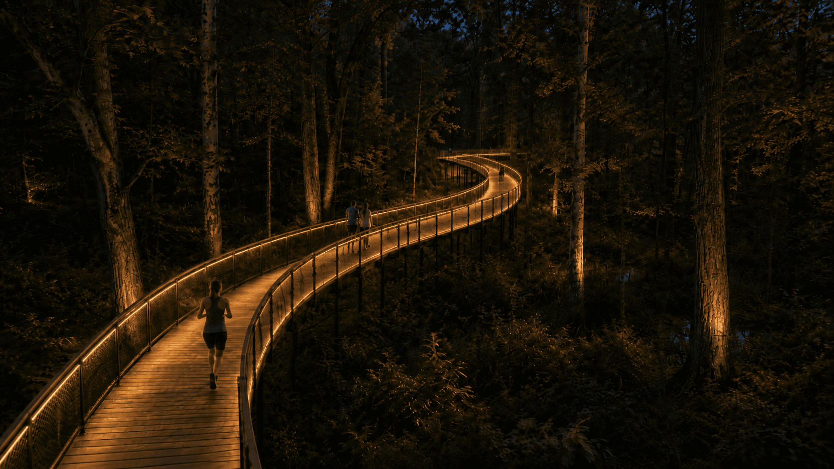
A potential TREC extension could create approximately two miles of public recreation through restored landscapes, forests and wetlands. Elevated crossings could be evaluated where appropriate, with the public corridor separated from private residential areas.
Any alignment or broader network connection would remain subject to landowner coordination, technical review and approval by the appropriate entities.
Potentially advancing a long-standing county trail objective1 through a publicly accessible Lake Sara trail corridor.

All trail mileage, alignments and connections are conceptual and would require coordination, technical review, participation, funding and formal approval.
THE RESIDENTIAL COMPONENT
Create waterfront carefully. Preserve substantially more.
The concept contemplates a limited expansion of Lake Sara capable of creating approximately 50 new waterfront homesites. Residential areas would be concentrated rather than spread across the broader assemblage, allowing substantially larger areas to remain natural, restored or undeveloped.
Private neighborhood access, lakefront development, and water use would remain subject to applicable engineering, environmental, landowner, and Effingham Water Authority requirements.
Although located outside municipal boundaries, the concept could contribute to Effingham’s broader housing, recreation, environmental, employer-recruitment, and regional-growth objectives.
THE NEXT STEP
Study it seriously.
A concept of this scale should advance only if the environmental, engineering, economic and community case can withstand rigorous analysis. A future feasibility process could involve coordination with organizations and agencies involved in Lake Sara, soil conservation, watershed protection, habitat restoration and water quality.
THE IMMEDIATE ASK
Coordination. Technical conversation. Structured preliminary review. Not funding. Not approval.
Lake Sara 2030 remains a preliminary private concept. The immediate objective is to determine whether the environmental, engineering, regulatory and economic case warrants deeper study with appropriate stakeholders.
QUESTIONS & ANSWERS
A preliminary concept, stated plainly.
IS LAKE SARA 2030 APPROVED? — No. Lake Sara 2030 is a privately initiated preliminary concept. Land assembly, engineering, environmental review, permitting, agency coordination and other approvals would be required before any major component could proceed.
IS THIS PRIMARILY A HOUSING DEVELOPMENT? — The revised concept is being evaluated as a combined watershed-restoration, lake and limited residential initiative. Approximately 50 potential waterfront residences would represent one component of a substantially larger land-restoration strategy.
ARE 250 ACRES ALREADY ENROLLED IN CONSERVATION PROGRAMS? — No. Approximately 250 acres have been identified for further evaluation. Specific acreage, conservation practices, funding programs and participation would depend on land control, technical analysis and program eligibility.
ARE GOVERNMENT GRANTS ALREADY COMMITTED? — No. Various federal and state conservation and water-quality programs may ultimately be evaluated, but no funding should be represented as committed unless formally awarded.
WOULD THE LAND BECOME PUBLIC? — The current concept assumes primarily private ownership. Specific public-access corridors, conservation agreements or program requirements would be evaluated individually.
IS THE TREC EXTENSION APPROVED? — No. The trail alignment is conceptual and would require coordination with TREC, affected landowners and appropriate public partners.
PRELIMINARY CONCEPT
Watershed first. Lake second. Residential third.
Lake Sara 2030 remains a privately initiated, early-stage concept. The broader land assembly is not complete, and no final engineering, environmental review, restoration plan, grant award, agency commitment, trail approval, infrastructure plan or formal project approval has been completed. All acreages, residence counts, alignments and outcomes are approximate and subject to change.
01
CONCEPT DEVELOPMENT
02
LANDOWNER AND AGENCY CONVERSATIONS
03
TECHNICAL FEASIBILITY AND ENVIRONMENTAL REVIEW
04
FORMAL PLANNING AND APPROVALS

SOURCES & PLANNING DOCUMENTS
Public documents and official reference pages provide supporting evidence and planning context only. Third-party materials do not constitute endorsement of Lake Sara 2030.